Featured projects
CARES conducts a variety of projects in the areas of data visualization, web development, spatial analysis, data processing, and mapping. Through our projects, we have supported or partnered with federal, state, and local governments, foundations, researchers, non-profits, and private industry to apply our skills and resources to a wide variety of issues and topics. The results of these projects help create a better informed world through published results, publicly accessible data and tools, or direct support to decision makers.
See below for selected examples of current and recent projects:
Image
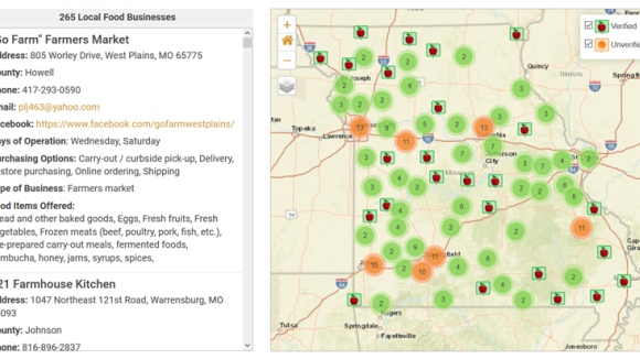
Missouri Food Finder
The Missouri Food Finder is an online tool that easily connects Missouri consumers with the people who are growing and selling locally produced food in their region. Farmers, growers, and local suppliers can enter basic information about the food they sell, their hours, location, and contact information. That information will automatically show up on a Missouri map. Consumers simply type in their location to see what options are available in the area they select.
Image
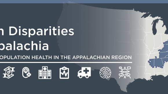
Health Disparities and Bright Spots in Appalachia
Creating a Culture of Health in Appalachia: Disparities and Bright Spots is an innovative research initiative sponsored by the Robert Wood Johnson Foundation (RWJF), Appalachian Regional Commission (ARC), and administered by the Foundation for a Healthy Kentucky. This project measures population health and documents disparities in health outcomes within the Appalachian Region; identifies “Bright Spots,” or communities that exhibit better-than-expected health outcomes; and explores in-depth case studies of a sample of Bright Spot communities.
Image
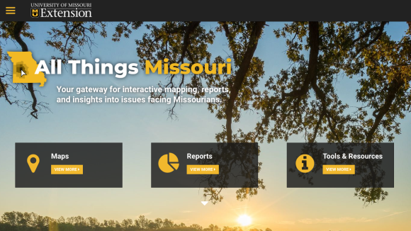
All Things Missouri
All Things Missouri houses maps, data, reports, and resources to help professionals address the grand challenges that emerged from the University of Missouri Extension's 2017 listening tour. The portal is designed to support decision-makers in accessing, analyzing, and visualizing data to inform better and more data-driven strategies. The goal of the site is to support a variety of sectors – business, local and state organizations, nonprofits, governments, researchers, and Extension staff – to understand community needs and resource allocation.
Image
US News Healthiest Communities Rankings
The U.S. News Healthiest Communities rankings measure health-related components of society with the aim of empowering citizens, health care leaders, and officials to make decisions about policies and practices that can improve health outcomes for all. Guided by a pioneering framework developed by a committee appointed to advise the U.S. Department of Health and Human Services, the project scores nearly 3,000 counties on approximately 80 indicators across 10 categories that drive health outcomes.
Image

exploreMohealth
ExploreMOHealth is a rankings tool with support from the Hospital Industry Data Institute and the Missouri Hospital Association. ExploreMOHealth provides ZIP code level rankings across major health behaviors and health outcomes in Missouri.