Many people in urban and suburban areas want the chance to experience nature and wildlife in their neighborhoods. They may want to enjoy the sight of browsing deer, the sound of singing birds, the smell of blossoming flowers or the feel of cooling shade provided by mature trees. Urban and suburban environments in Missouri can, and many do, provide habitats that sustain native plant and animal communities and thus improve quality of life for Missourians. However, without land-use planning that encompasses these habitats, they may be unnecessarily destroyed or unwittingly diminished. The natural resource assessment tool in this publication can aid in such planning. Individual homeowners, neighborhood groups, developers and city planners who are interested in enhancing wildlife habitat and managing natural resources within a community or neighborhood can use this assessment tool to gather information on the species of wildlife and types and conditions of vegetation in the area. This information can be used to develop a plan to protect, or establish, and manage native vegetation that is beneficial to a variety of wildlife species.
Overview
Rural, urban and suburban environments provide habitats that sustain native plant and animal communities. New residential developments and older neighborhoods are often situated in or near such habitats. Conserving or restoring the unique natural features inherent in these environments benefits the local environment, area landowners, residential property owners and the region's natural heritage.
Wildlife habitat is a product of land use in a particular area, whether rural or urban. These habitats have intrinsic value and can improve the local resident's quality of life and become important to the community. Wildlife habitats found in urban environments — in new subdivisions, older residential neighborhood, developments, parks and open spaces — can provide important vegetation and plant communities that are beneficial for a variety of species (Figure 1). Open areas, parks and forested habitats within urban environments may provide the only links many people have to nature and thus are important assets to the quality of life in the community (Figure 2).
Without land-use planning that considers native plant and animal communities, wildlife habitats are destroyed and developers often spend money to overcome nature rather than work with the realities of land, water, wildlife and weather. With planning, vegetation such as native plants, trees and shrubs can be maintained to provide numerous benefits (Figure 3).
Many individual homeowners landscape, garden, or plant trees and shrubs to attract songbirds and other wildlife, and add beauty by softening the outlines of masonry, metal and glass. Plants and trees also help naturally define property boundaries and can serve as visual and noise screens. Mature trees shade hard surfaces such as driveways, patios and sidewalks and minimize landscape heat load. In particular, trees on the south and west sides of homes can reduce air conditioning costs up to 30 percent and soften harsh, winter winds.
When individual residential lots are managed in concert with the larger landscape — which can include vacant lots, parks, areas alongside streams and small woodlots — not only do wildlife communities benefit, but humans do as well. Plants, shrubs and trees help trap and hold dust and pollen that can damage human lungs, and lessen the amount of chemicals transported to streams; and one acre of them produces enough oxygen for 18 people every day. Plus, without plants and trees, cities and towns would need to spend more time and money building and maintaining storm-water drainage channels.
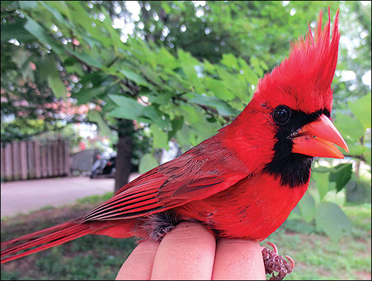
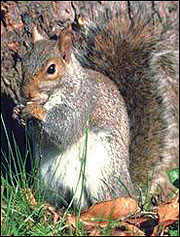
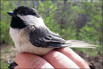 Figure 1
A variety of songbirds and many other wildlife species are attracted to habitats found in urban and suburban areas.
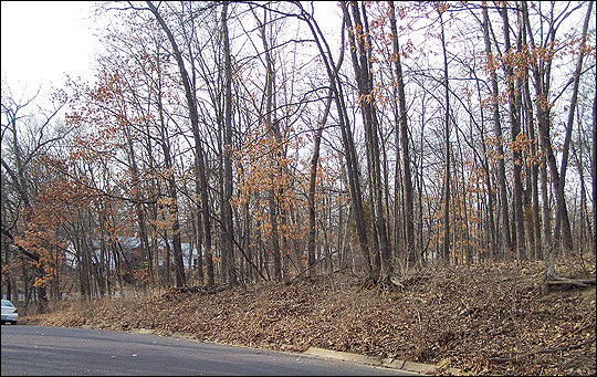
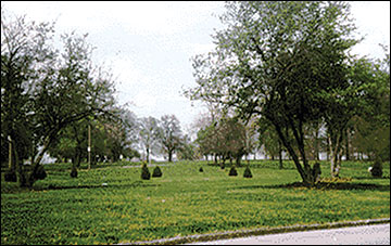 Figure 2
Parks and open areas are often the only links people living in urban environments have to nature.
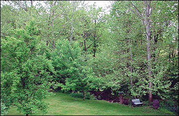 Figure 3
With proper planning, native vegetation, trees and shrubs can be maintained to provide many benefits for wildlife and areas for relaxation.
Assessing an area's natural resources
The following natural resources assessment tool provides a means to help identify priorities and issues that need to be addressed to enhance an area's wildlife habitat and natural resources. The tool was designed by Frey (1999) to be used by individuals or groups interested in enhancing wildlife habitat and managing natural resources within a community or neighborhood. Residents are likely to be most familiar with the wildlife habitat and natural resource features within a community or neighborhood. The scale or size of a particular neighborhood is usually defined by the local residents, and it is at this small scale that many urban residents have the most encounters with nature or wildlife.
The assessment tool is organized in two parts: defining the land cover that is present and classifying it into habitat types, and identifying important features that make the existing habitats special. The plant community and vegetation present will greatly influence the types of wildlife that will be attracted to the area, and important features and special locations may support wildlife or provide unique environments that are beneficial for the neighborhood residents and community.
The assessment tool relies on the user's ability both to identify and categorize the vegetative characteristics of the area and to use this information to help make informed decisions about how these areas should be managed. The information gathered can be used to facilitate discussion among stakeholders, including the neighborhood residents, that will lead to improved decisions regarding the management of the natural resources within the area.
Part 1: Defining land cover and classifying into habitat types
Land cover refers to the type of vegetation or land use that covers the ground at different places in a neighborhood or community. Habitats are places that provide food, cover, water and space for species and communities of wildlife. Land cover can be classified into a variety of habitat types. Table 1 lists land cover, or biotope, types commonly found in communities and neighborhoods. Table 2 provides an example of the habitat types and subtypes into which land cover can be divided.
Aerial photos provide a unique view of a neighborhood and can be used to identify the types of land cover present and define the area each covers. Aerial photos can be obtained or downloaded from a variety of sources, including the University of Missouri Center for Applied Research and Environmental Systems (CARES), http://www.cares.missouri.edu, or Google Earth, http://earth.google.com.
In addition to using aerial photos to identify land cover types, you will need to spend time on the area observing existing conditions. As you walk or drive through the community or neighborhood, begin to subdivide the land cover types you see into more specific habitat types that are important features in the area (Figure 4). Several habitat characteristics can be used to determine whether an area currently provides or is capable of providing the appropriate habitat components for wildlife species of interest. Some locations will provide the types of vegetation needed for a diversity of wildlife species; others may not. The numerical values on Tables 1 and 2 can be assigned to the observed land cover and habitat types for use in the development of a land cover map and additional planning.
Table 1. Land cover types found in many communities and neighborhoods.
| Category | Description | ||||
|---|---|---|---|---|---|
| 1000 | Houses | ||||
| 2000 | Farm houses, old farm buildings | ||||
| 3000 | Industrial and commercial buildings | ||||
| 4000 | Parks, cemeteries, ball fields, planned open spaces | ||||
| 5000 | Rivers, creeks, ponds, lakes | ||||
| 6000 | Roads, railroads, trails, parking lots | ||||
| 7000 | Fields, orchards, grasslands | ||||
| 8000 | Forests, woodlands, hedgerows | ||||
| 9000 | Vacant lots, landfills, quarries | ||||
| 0000 | Other | ||||
| Note Numerical values are used in development of a land cover map. |
|||||
Table 2. Habitat types and subtypes into which land cover types can be divided.
| Category | Description |
|---|---|
| Habitat types | |
| 1100 | Apartment complexes |
| 2300 | Farm houses |
| 3100 | Warehouses |
| 4200 | Cemetery |
| 5100 | County house branch |
| 6100 | Right of ways |
| 7600 | Remnant prairie |
| 8100 | Flood plain forest |
| 9300 | Quarries |
| Habitat subtypes | |
| 4233 | Old city parks with mowed grass |
| 5521 | Dry creek beds |
| 7611 | Orchards |
| 9320 | Open lands or grasslands with tall grass |
| Note Numerical values are used in development of a land cover map. |
|
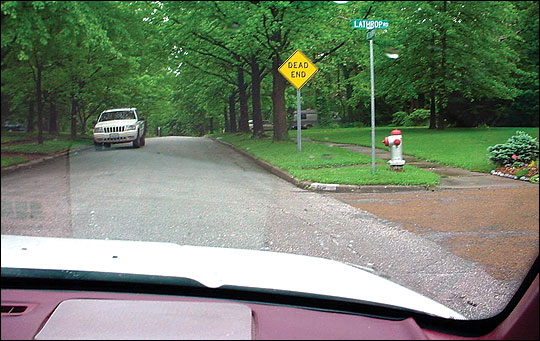
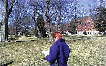 Figure 4
Walk and drive through the neighborhood to identify and assess land cover types, habitat conditions and unique natural features.
Part 2: Identifying special features
Once the land cover and habitat types have been classified, a map can be developed to facilitate additional planning. The map can be used to make preliminary habitat assessments and as a tool for identifying the characteristics that make certain places in the neighborhood special or unique and valuable as wildlife habitat. The characteristics of two place types are described below.
Places with natural features
Identify areas that have special or unique natural features:
- Scenic places: Forest, meadows, lakes and ponds, streams
- Special features: Big mature trees, hedgerows, morels in the spring
- Water: Springs, places to catch fish, places to hear frogs
- Animals: Fox dens, bird nests, butterflies, deer trails
- Seasons: Spring flowers, fall colors
- Sounds: Water flowing, songbirds singing, coyotes howling
- Smells: Flowers in spring, leaves in fall
Places for recreation or relaxation
Identify areas appropriate for various activities:
- Walking or jogging
- Bike riding
- Playing or running around
- Picking flowers or blackberries, or hunting for mushrooms
- Picnicking
- Relaxing
Other ecological attributes
Once you have identified the land cover, habitat types and special features of the area, the next step is to identify other important ecological attributes that should be considered before implementing a management plan. Figure 5 provides an example of a scale that can be used to rate the existing condition of certain ecological attributes or characteristics within an area, using various natural resource criteria as a means to determine and identify additional benefits that may exist. If the ratings for most of the criteria are on the low end of the scale, then appropriate actions will need to be taken to improve habitat conditions within the area.
| Natural resource rating scale | |||||
|---|---|---|---|---|---|
| Criteria | Scale | ||||
| Few | Many | ||||
| Species of local interest present (birds, mammals, reptiles, amphibians, butterflies, insects) | 1 | 2 | 3 | 4 | 5 |
| Low | High | ||||
| Vertical structure and diversity of vegetation (plants of various heights from grasses and flowers to shrubs and trees) | 1 | 2 | 3 | 4 | 5 |
| Low | High | ||||
| Horizontal structure and diversity of vegetation (diversity of vegetation across a landscape as determined from an aerial photo) | 1 | 2 | 3 | 4 | 5 |
| Too small | Marginal | Adequate (supports animals' needs) | |||
| Patches or clumps of vegetation (area of sufficient size to support the habitat needs of various species of wildlife; not isolated plants or places) | 1 | 2 | 3 | 4 | 5 |
| Few | Marginal | Many | |||
| Vegetation corridors (linkages of plants across the landscape that allow wildlife to move among habitat areas) | 1 | 2 | 3 | 4 | 5 |
| Difficult to Improve | Marginal | Relatively easy to improve | |||
| Suitability or capability (habitats suitable for wildlife or capable of being improved) | 1 | 2 | 3 | 4 | 5 |
| Other unique features |
|||||
Use of the assessment tool by select neighborhood associations in Columbia, Mo.
Residents representing select neighborhood associations in Columbia, participated in workshops that provided information on wildlife in urban areas, vegetation and habitat management, and on how to use aerial photos to identify important habitat and natural resource features. The participants used aerial photos to identify valued places within their neighborhoods.
To gather information, participants also walked and drove through their neighborhoods, identified and photographed various features and places of importance, and recorded their observations and the reasons for designating or identifying a certain habitat type or special feature. Figures 6 to 11 depict habitat types and special natural features found in the areas. Once these land cover and habitat types were identified, the residents developed maps of their neighborhoods to identify component and locate features and places that they had designated as important.
This process was also used to develop a biotope, or land cover, map for the City of Columbia. (Figures 12 and 13, Table 3). The biotope map depicts land use, habitat types and land cover types within the city, and can be used as a planning tool with neighborhood residents and city planners as a means to ensure that important habitat features and special features that provide benefits are maintained within the community.
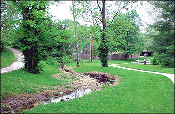 Figure 6
Trails and habitat are valuable areas in a neighborhood.
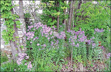 Figure 7
Screening cover along a neighborhood road provides valuable wildlife habitat.
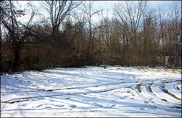 Figure 8
Vacant lots provide valuable habitat areas.
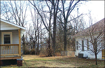 Figure 9
Wood vegetation beside alleys provides valuable neighborhood habitat.
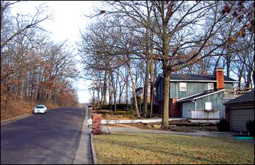 Figure 10
Mature trees and small woodlots were identified as valuable habitats in several neighborhoods.
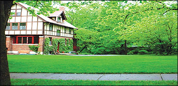 Figure 11
Mature trees and small woodlots were identified as valuable habitats.
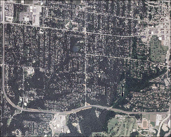 Figure 12
Aerial photo depicting habitat and land cover types used to develop a biotope map of west-central Columbia, Mo., neighborhoods.
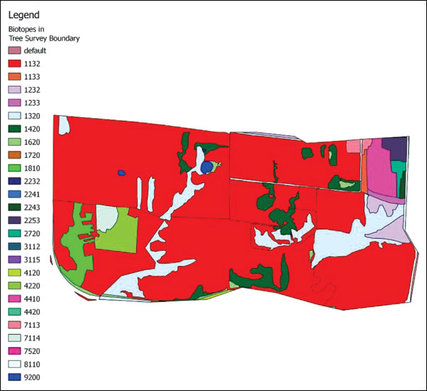 Figure 13
Biotope map depicting the land cover within several Columbia, Mo., neighborhoods.
Table 3. Biotope types mapped by neighborhood associations in west-central Columbia, Mo., neighborhoods
| Category | Description |
|---|---|
| 1132 | Single family residential with lawn, tree and shrubs — yard trees |
| 1133 | Single family residential with lawn, tree and shrubs — fence row trees |
| 1232 | Multifamily residential with lawn, tree and shrubs — yard trees |
| 1233 | Multifamily residential with lawn, tree and shrubs — fence row trees |
| 1320 | Residential — closed deciduous forest |
| 1420 | Residential — deciduous woodland |
| 1620 | Residential — herbaceous, grassland |
| 1720 | Residential — scarcely vegetated, bare soil |
| 1810 | Residential — riparian, trees |
| 2232 | Commercial — commercial strip with lawn, tree and shrubs — yard trees |
| 2241 | Commercial — commercial strip with lawn and trees — street trees |
| 2243 | Commercial — commercial strip with lawn and trees — fence row trees |
| 3112 | Industrial — buildings with lawn and shrubs |
| 3115 | Industrial — buildings with trees |
| 4120 | Park or open space — closed deciduous forest |
| 4220 | Park or open space — deciduous woodland |
| 4410 | Park or open space — herbaceous grassland |
| 4420 | Park or open space — meadow and lawn |
| 7113 | Institutional — buildings with lawn, trees, and shrub |
| 7114 | Institutional — buildings with lawn and trees |
| 7520 | Institutional — meadow or lawn |
| 8110 | Transportation — roads without vegetation |
| 9200 | Water — pond |
Conclusion
Habitats within urban and suburban environments can be managed to sustain a variety of plant and animal communities, improving the quality of life for residents in these areas. These habitats are of special value to native vegetation and wildlife in urban areas. Besides providing habitats for wildlife, the vegetation also provides countless benefits to residents, including beauty, visual and noise screens, physical barriers, oxygen production, carbon dioxide consumption and pollutant filtering. Often, urban wildlife habitats and the outdoor recreational areas that they provide may be the only links that many people have to natural environments.
In many locations within subdivisions, neighborhoods, cities and towns, environments can be enhanced by valuing, protecting and managing vegetation. This publication describes a process that can be used to assess urban wildlife habitats and ecological features within these environments that are important to local residents. By mapping biotopes and identifying important habitats and land-use types within a neighborhood, local residents and community leaders can begin to inventory and objectively assess these areas and develop strategies to improve and manage these important features in their communities.
Contact your local MU Extension Center or the Missouri Department of Conservation for additional information on managing vegetation and integrating wildlife habitats in urban areas.
Additional information
- Allen, Steve, Susan Moore, Leslie Moorman, Chris Moorman, Nils Peterson, and George Hess. n.d. Conservation subdivision handbook: A guide for North Carolina communities in the use of conservation design for land use planning. North Carolina Cooperative Extension Service.
- Frey, Jochen. 1999. "Practical aspects of biotope mapping in cities: Methods, problems and solutions. An example of Mainz, Germany." Deinsea 5:41–56.
- Huber, Jeff. 2010. Low impact development: A design manual for urban areas. Fayetteville: University of Arkansas Community Design Center.
- Missouri Department of Conservation Your Property resources.
Funding for the development of this educational project was provided by the U.S. Forest Service, Midwest Center for Urban and Community Forestry.
Photo credits: Christine Rega, Robert Pierce and Charles Nilon.