Geographic Information Systems (GIS) and Global Positioning Systems (GPS)
Geographic Information Systems (GIS) and Global Positioning Systems (GPS) are powerful tools for collecting and analyzing spatial data to better understand relationships, patterns, and trends across various geographic contexts. It has the potential to be used in almost every field and is very versatile.
GIS is essentially a high-tech map! Unlike paper maps, GIS can allow the user to change the information shown as well as ask questions about the relationships between that information. GIS combines layers of information about a place to give a better understanding of that place. What layers of information are combined depends on the purpose. GIS software is becoming more sophisticated with the rapidly developing technology.
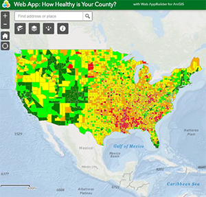
GPS is a network of satellites that continuously transmit coded information, which makes it possible to precisely identify locations on Earth by measuring distance from the satellites. National Team StoryMap on Health Data
National 4-H Geospatial Team
The National 4-H Geospatial Team educates youth in geospatial technologies, equipping them with critical skills and fostering professional growth. Our mission is to empower young leaders to undertake meaningful research and public service projects addressing diverse challenges across the nation. Through our training in GIS and GPS, we inspire all members to lead community service projects that revolve around and collaborate with educational and governmental institutions for mutual development.
Our team has many youth and adult members from across the county. We convene once every month to discuss progress updates and collaborate. With 2025, we hope to introduce many other states into our team and spread the power of GIS across the nation.
Youth Engagement
Youth Check-ins
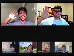
Youth Check-ins are a cornerstone of the National Team. Check-ins are hosted every Thursday and provide our youth members an opportunity to collaborate on tasks, as well as share ideas. These sessions also offer:
- Mentorship: Providing guidance to members to enhance individual youth projects and learn new skills.
- Leadership Development: Training to enhance public speaking, teamwork, and initiative-taking.
Career Nights
Career Nights are also hosted weekly and provide our youth an opportunity to explore new fields. Thus fare, our youth have connected with professionals across STEM, agriculture, and geospatial sciences. Guest speakers share career insights and provide networking opportunities, broadening participants’ perspectives and inspiring future goals.
Conferences
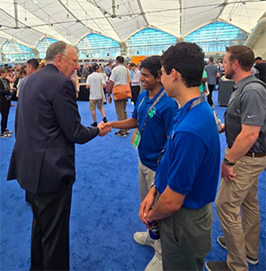
Members of our team have the opportunity to attend conferences like NC GIS 2025, the Greensboro Conference, and the ESRI User Conference 2025, where they present their research and connect with experts. Our statewide events focus on addressing regional issues and engaging with local stakeholders, while national conferences provide a platform to collaborate with industry leaders and policymakers. These experiences help amplify the impact of youth-driven projects and showcase the vital role of young innovators using GIS to tackle complex challenges.
Accessibility
The National Team ensures that accessing GIS tools and resources is simple and inclusive for all participants. To use GIS effectively, all that is required is an internet connection and a device. Additionally, all surveys and data collection can be conducted using a standard mobile phone. Furthermore, all necessary software is provided at no cost to members. This includes the entire ArcGIS Engine and its many tools like Business Analyst, ArcGIS Online, Survey123, and ArcGIS StoryMaps.
Youth Research Projects
Youth-Led Projects
One of the National Team’s most impactful offerings is the opportunity for youth to lead their own research projects. These projects empower participants to explore topics they are passionate about through utilizing several ArcGIS tools. From mapping local river basins to urban planning, youth can select niche areas of interest that align with their personal goals and community needs.
Data Exploration
With reputable global datasets on ArcGIS, participants can ensure their research is grounded with reliable and comprehensive information. Additionally, the National Team prides itself on conducting research that is high-quality and meets professional standards. Moreover, the team’s strong partnerships with entities like the USDA and other leading institutions provide further support, expertise, and credibility for member’s projects.