-
Image
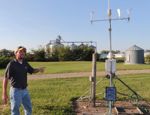 MU Extension state climatologist Zack Leasor, pictured, is working with state natural resources specialist Michael Sunde and John Travlos, co-director of the Missouri Mesonet, to add soil moisture sensors to many of the Mesonet's 45 weather stations across the state. Photo by Linda Geist.
 -
Image
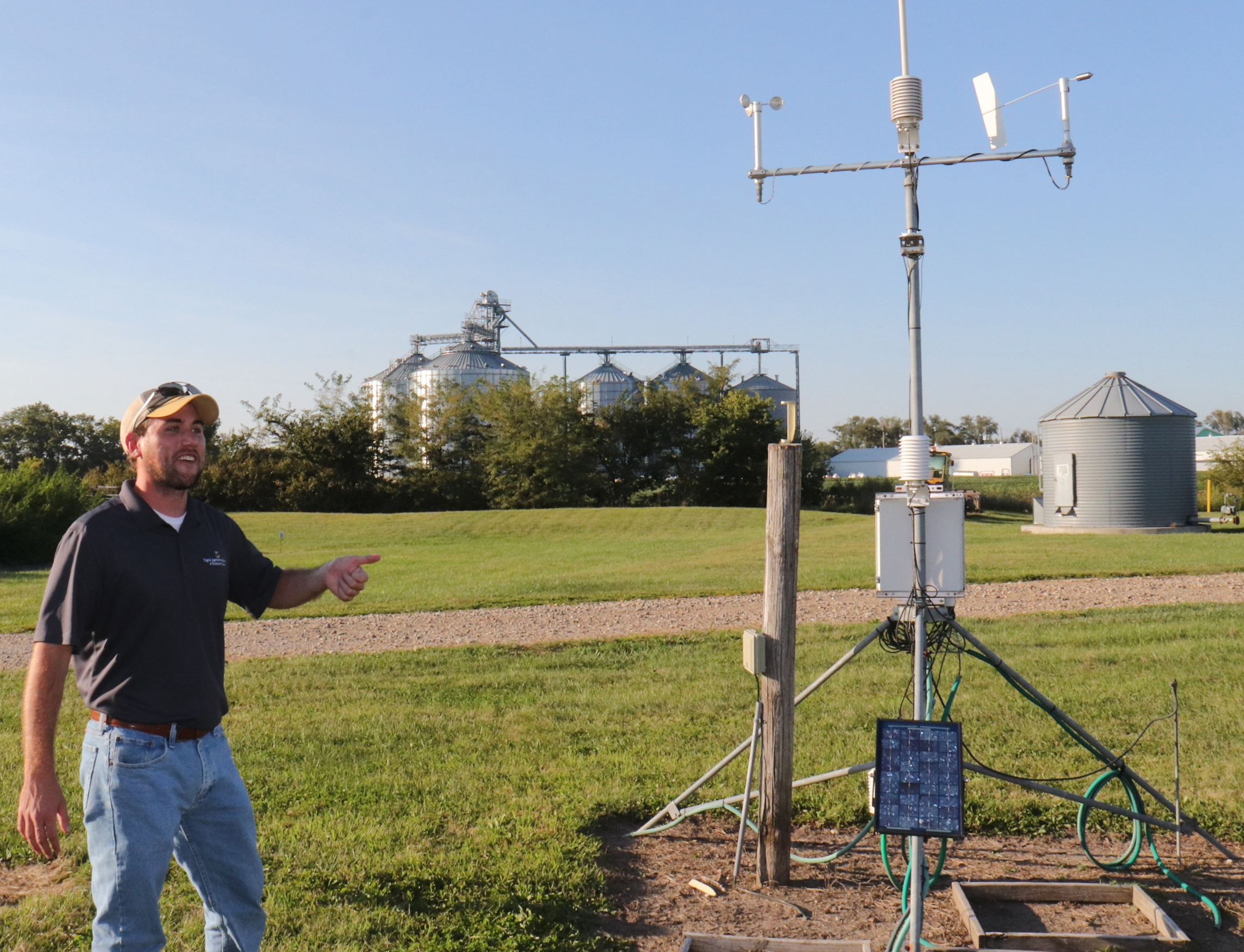
 Some of Missouri Mesonet’s 45 weather stations will be upgraded with new sensors that will provide long-term soil moisture information to help forecast, monitor and respond to flood and drought. Photo courtesy of Zack Leasor.
 -
Image
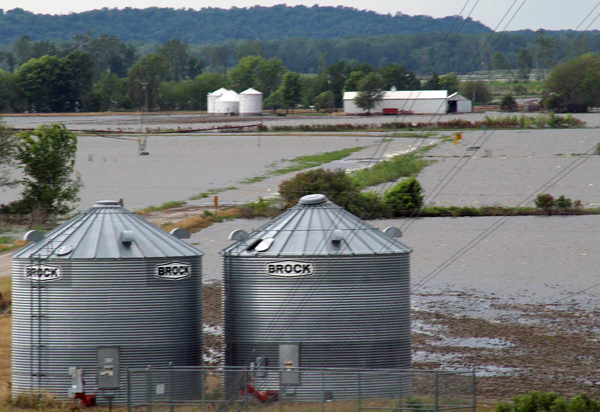
 Collected data will be used as part of MU Extension’s studies on drought and floods, which have a profound impact on Missouri’s environment and agricultural economy. Nearly 40% of the flood-affected farmers reported financial losses of $100,000 or more following flooding in Missouri in 2019, according to a National Institutes of Health report with contributions from MU Extension economists. 2019 file photo of Holt County flooding by Linda Geist.
COLUMBIA, Mo. – University of Missouri Extension’s network of weather stations will soon be updated to provide long-term soil moisture information to help forecast, monitor and respond to flood and drought.
MU Extension state natural resources specialist Michael Sunde and state climatologist Zack Leasor will work alongside John Travlos, co-director of the Missouri Mesonet, to add new soil moisture sensors to many of the network’s 45 weather stations.
The additions are part of a project to develop a statewide soil and atmospheric monitoring plan and to produce soil moisture maps for Missouri.
MU’s Missouri Climate Center and the Missouri Resource Assessment Partnership will use machine learning to help create statewide gridded soil maps that will be updated daily, Leasor says. “This will go a long way to improving the quantity and resolution of available soil moisture data across the state,” he says.
“Sound science and data are essential elements for developing informative statewide soil moisture and temperature maps,” says Sunde. “This work will provide state and federal partners a monitoring plan to guide the expansion of long-term soil and atmospheric monitoring stations across the state.”
Soil moisture and temperature affect the physical, chemical and biological processes in soil and resident vegetation, Sunde says. Soil moisture information helps in understanding the potential for the storage and movement of water within the soil profile. Soil moisture also influences critical exchanges of water between the atmosphere and land surface.
Collected data will be used in studies of drought and floods, which have a profound impact on Missouri’s environment and agricultural economy. Missouri experienced historic floods in 1993, 1998, 2011 and 2019.
The Missouri Mesonet currently measures air temperature, 2- and 4-inch soil temperature, rainfall, relative humidity, dew point temperature, solar radiation and temperature inversions in real time. The network also provides historical data going back to 2000.
The Missouri Resource Assessment Partnership, established in 1996 as part of the MU School of Natural Resources, develops, analyzes and delivers geospatial and remotely sensed data. The partnership will use geospatial analysis, remote sensing and environmental modeling to provide practical information that the agricultural community can use.
The work is part of Missouri Hydrological Information Center and Missouri Department of Natural Resources. The center was established at the recommendation of the Flood Recovery Advisory Working Group convened by Missouri Gov. Mike Parson.
Photos
Zack Leasor and a weather station
MU Extension state climatologist Zack Leasor, pictured, is working with state natural resources specialist Michael Sunde and John Travlos, co-director of the Missouri Mesonet, to add soil moisture sensors to many of the Mesonet’s 45 weather stations across the state. Photo by Linda Geist.
Soil moisture sensors
Some of Missouri Mesonet’s 45 weather stations will be upgraded with new sensors that will provide long-term soil moisture information to help forecast, monitor and respond to flood and drought. Photo courtesy of Zack Leasor.
Flooding in Holt County
Collected data will be used as part of MU Extension’s studies on drought and floods, which have a profound impact on Missouri’s environment and agricultural economy. Nearly 40% of the flood-affected farmers reported financial losses of $100,000 or more following flooding in Missouri in 2019, according to a National Institutes of Health report with contributions from MU Extension economists. 2019 file photo of Holt County flooding by Linda Geist.