-
Image
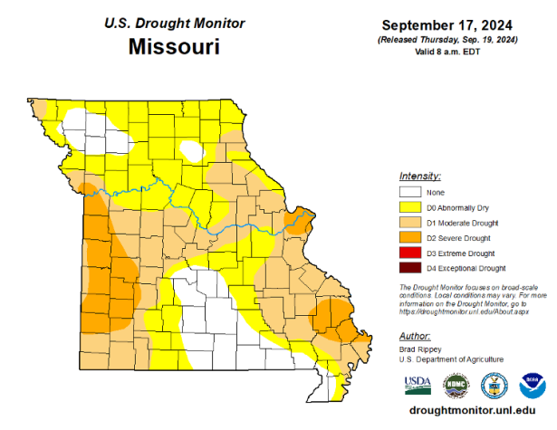 U.S. Drought Monitor report for Missouri, Sept. 17, 2024.
 -
Image
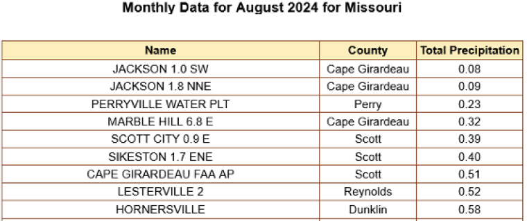
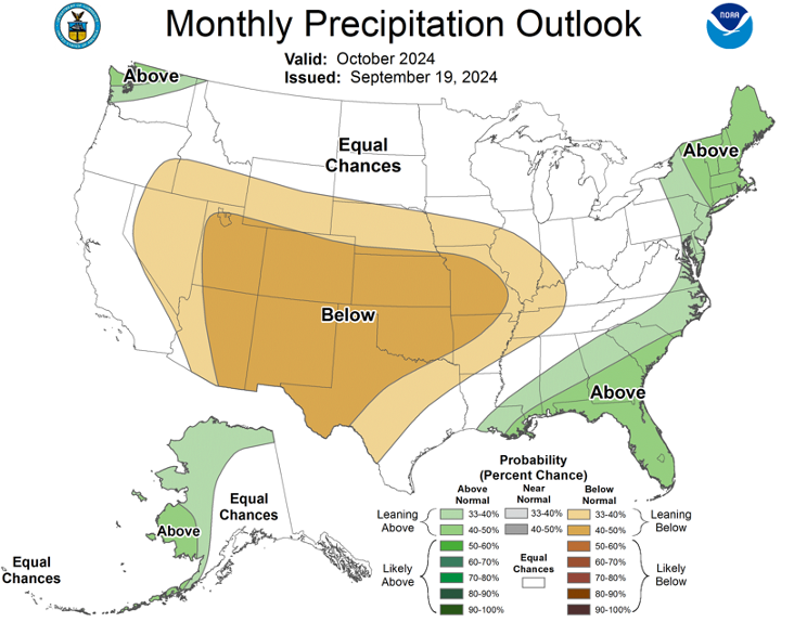
 U.S. Drought Monitor precipitation outlook for October 2024.
 -
Image
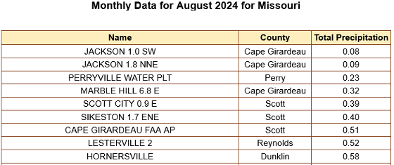
 Parts of Missouri received scant precipitation in August.
COLUMBIA, Mo. – After experiencing drought in 2022 and 2023, Missourians were eager for a wet growing season. Missouri saw above-average statewide monthly precipitation from April to July, says University of Missouri Extension state climatologist Zachary Leasor.
On July 23, the U.S. Drought Monitor reported only 1.1% of the state as abnormally dry, and there was no drought in Missouri. Some areas were even dealing with too much water, with160 flash flood and 297 river flood warnings in Missouri from April to July, says Leasor.
Midway through July, however, much of the state started to dry out, and this pattern continued into August. Preliminary statewide average precipitation during August was 2.81 inches, 0.91 inch below the monthly average.
Portions of southeast Missouri received less than 0.5 inch of rainfall during August, and Pemiscot County recorded its third-driest August on record. Seven other counties in southeastern Missouri recorded a top five warmest August on record.
Southeastern Missouri benefited from the remnants of Hurricane Francine in September, but the rest of the state was mainly dry during the first half of the month, says Leasor. Columbia and Kansas City received only a trace of rain during the first 18 days of the month.
By Sept.19, more than 80% of Missouri was classified as abnormally dry, with 47% of the state in moderate drought. The U.S. Drought Monitor reported areas of severe drought in southeastern Missouri, the St. Louis metro area and west-central Missouri along the Kansas border.
Some locations saw a three-class degradation in U.S. Drought Monitor status in just one month. Late-season agricultural impacts included dry pastures and reduced hay availability, crop stress in soybeans and low pond levels.
“Fortunately, a multiday event brought beneficial rainfall to nearly all of Missouri from Sept. 20-25,” says Leasor. “However, much of the state remains behind on rainfall over the past 60 to 90 days.” The Climate Prediction Center at the National Oceanic and Atmospheric Administration predicts a 33%-50% chance of a drier-than average October for the state.
“Without additional rainfall, the state could expect the persistence or degradation of drought conditions,” he says. “Fall drought impacts can include an increased fire risk, difficulties with fall hay cutting and cover crop planting, and low stream flow. The state’s next chance for significant rainfall will come with the remnants of Hurricane Helene.”
Images
Parts of Missouri received scant precipitation in August
Parts of Missouri received scant precipitation in August.
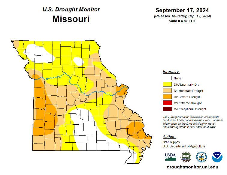
Missouri drought map
U.S. Drought Monitor report for Missouri, Sept. 17, 2024.
U.S. Drought Monitor precipitation outlook for October 2024
U.S. Drought Monitor report precipitation outlook for October 2024.