For compliance with the Enlist labels registered in February 2022, producers must know the Hydrologic Soil Group (HSG) for the soil series on which they are applying the herbicide. HSGs are used to estimate runoff potential of a soil, and now they will be used to determine which mitigation measures a producer needs to implement before applying these products. This tutorial is intended to simplify your HSG determination.
An HSG A or B requires mitigation measures to equal a minimum of four credits. These measures can be selected from the tables provided on page 4 of the Enlist One and Enlist Duo labels. For an HSG of C or D, mitigation measures must be selected to equal a minimum of six credits.
A relatively simple way to determine the HSG at your application site is to use the USDA Web Soil Survey. Click on the green button labeled “START WSS”.
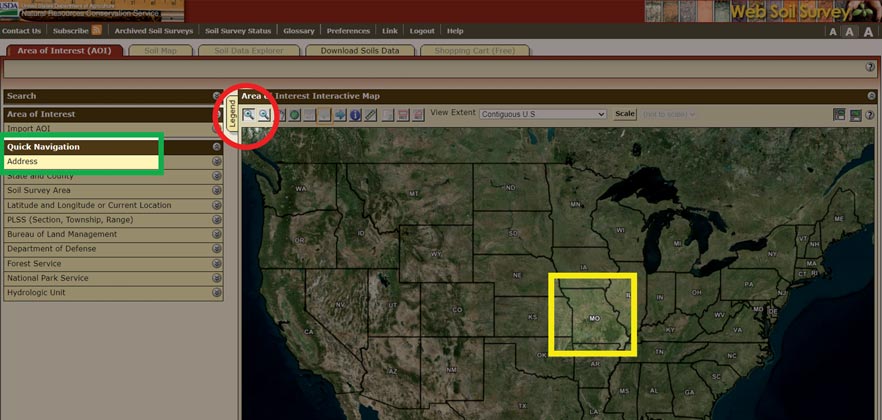
This takes you to a map of the United States (Figure 1). Click on the zoom icon (circled in red) and use the cursor to draw a rectangle around Missouri or search for a specific address under “quick navigation” on the left-hand side (highlighted in green).
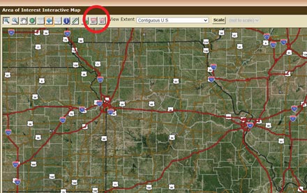
A zoomed map of Missouri will appear (Figure 2). From here, continue zooming your way toward your property by drawing increasingly smaller boxes until you recognize the field to be sprayed.
Once you zoom down to your property, click the AOI (area of interest) icon (circled in Figure 2) and use the cursor to surround your property or the field you plan to spray.
Now you have captured your work area giving you access to soil data. Your AOI should appear like Figure 3.
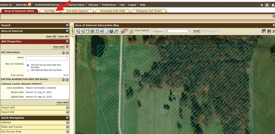
Now you can click on the “Soil Map” tab at the upper left to create a soil map of your work area (highlighted by the arrow in Figure 3). Note the number within the polygon of the field you plan to spray and click on the corresponding soil series in the table on the left of the screen, as shown in Figure 4.
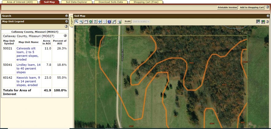
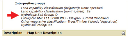
In this example, the number in the hypothetical application site is 50021, which corresponds with the Calwoods silt loam in the box. Click on the blue “Calwoods silt loam” text and a Map Unit Description window will pop up for this soil series. Scroll to the bottom of this window to see the USDA-listed HSG (Figure 5).
Caution, while the Enlist label has an asterisk under the table that “defines” HSGs by soil texture, this is a generalization. Often a silt loam can be either HSG C or D, while a loam can be HSG A or C. While following the general guide on the label should suffice for FIFRA compliance, the most accurate method is to use the Web Soil Survey sequence outlined above to get site-specific data.
Additionally, some soils are listed in dual groups such as B/D. The first letter refers to the HSG in a drained condition, such as a field with a tile drain system, while the second letter indicates the HSG of the soil in its undrained, or natural condition.
Another consideration is what to do if your field falls within multiple HSGs. A conservative approach is recommended. To limit liability, we recommend using the most limiting HSG to calculate mitigation measures. In other words, if a field is interlaced with HSG B and D, calculate your mitigation measure score based on HSG D.