MU research helps planners target vulnerable communities before and after storms
-
Image
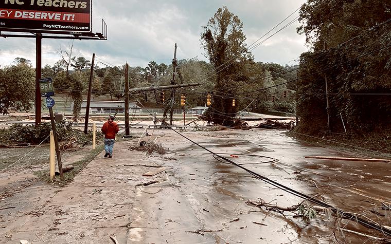 Asheville, NC, after Hurricane Helene in 2024. Photo by Bill McMannis via Wikimedia Commons. Shared under a Creative Commons license (CC BY 2.0).
COLUMBIA, Mo. – Geospatial analysis by University of Missouri Extension researchers can help planners and emergency managers better understand how social vulnerability shapes disaster impacts and recovery.
By mapping both exposure to disaster impacts and community-reported needs, the research can aid in prioritizing investments in preparedness, mitigation and recovery, says Michael Sunde, an MU Extension natural resources specialist.
Researchers combined satellite imagery and geospatial data, including road closures, population density and mobile home locations, to identify communities most affected by flooding and disruptions in the wake of Hurricane Helene, which caused widespread damage and loss of life in the southeastern U.S. in 2024.
Complementing this work, MU School of Social Work professor Jennifer First led a community survey examining health, housing, financial and infrastructure needs five months after the hurricane.
First, who is one of the country’s leading researchers on the relationship between climate and weather-related hazards and physical and mental health, says damage extended well beyond infrastructure.
“A substantial portion of residents continued to report moderate to severe mental health symptoms, including PTSD (35%) and depression (27%), alongside ongoing physical health issues linked to environmental exposures like mold and contaminated water,” First says.
“Residents described how damaged infrastructure, including debris, road closures, and prolonged power and communication outages, combined with displacement, health challenges and financial strain to create compounding burdens that made recovery more difficult and prolonged,” she said. “Many also expressed a sense of being left behind or unsupported, as recovery resources were delayed, difficult to access or insufficient for the scale of need.”
Together, the geospatial analysis and post-disaster survey data provide planners with a more complete picture of disaster impacts across southern Appalachia, linking where flooding occurred with who was most affected and why recovery was uneven.
The report highlights that “recovery is not a short-term phase but a multisystem, long-term process that requires community-driven planning and sustained investments that address these interconnected needs,” said First.
The study, Flood Exposure, Health Outcomes, and Recovery Needs Following Hurricane Helene in Southern Appalachia, published in the journal Environmental Hazards, offers a framework planners can use to anticipate post-disaster needs, identify high-risk areas and guide decisions related to land use, evacuation planning, infrastructure investment and disaster mitigation funding, she said.
The study found that more than 20% of North Carolina residents lived in areas with high social vulnerability during Hurricane Helene. Rural communities and low-income residents were hardest hit, with the most severe impacts among older adults, people with disabilities and those living in mobile homes.
The research can help move disaster planning from reactive to proactive, First said. By identifying where socially vulnerable populations and flood exposure intersect, planners can determine where resources should be pre-positioned, which infrastructure investments could reduce future losses and how recovery strategies can be designed to reduce long-term inequities.
Other authors on the publication were Megan Waddle and Brian Houston of the University of Missouri, Kristina Kintziger and Sarah Scales of University of Nebraska, and Kelsey Ellis and Jordan Fazio of University of Tennessee.
The project was funded by the National Hazards Center, University of Colorado, Boulder. The center’s research focuses on the social, behavioral, socioeconomic, mental health and other societal aspects of hazards and disasters, using quantitative, qualitative and mixed-methods approaches.
Photo
Asheville, NC, after Hurricane Helene in 2024. Photo by Bill McMannis via Wikimedia Commons. Shared under a Creative Commons license (CC BY 2.0).