-
Image
 Flooding in St. Louis in 2019. Adobe stock photo.
 -
Image
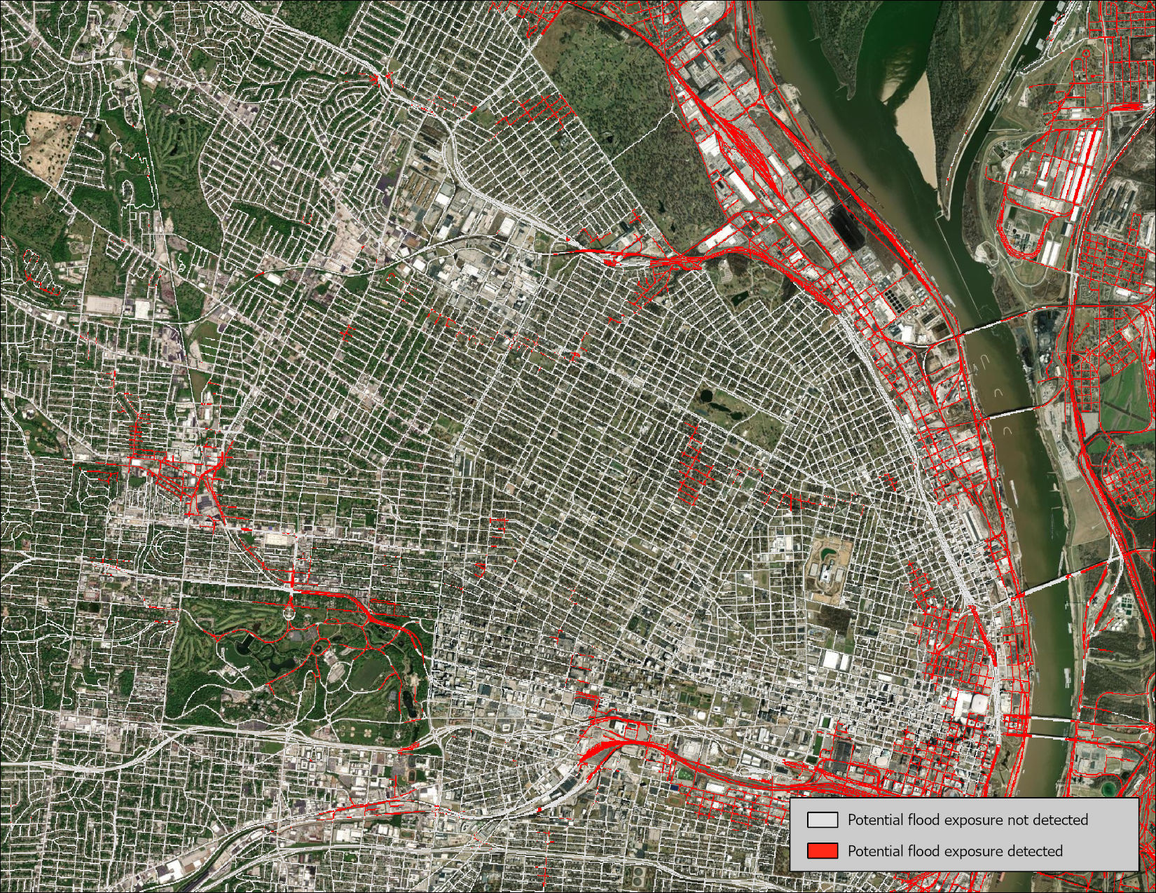
 This map shows the network St. Louis roads that are at risk of being affected by flooding. MU Extension researchers used historical data from the National Oceanic and Atmospheric Administration’s (NOAA) National Water Model to support flood-risk planning that helps protect St. Louis residents and travelers.
COLUMBIA, Mo. – University of Missouri Extension researchers have developed flood-risk maps that could help St. Louis-area planners, emergency responders and transportation agencies better prepare for flooding and protect residents and visitors.
In a report for the East-West Gateway Council of Governments in St. Louis, MU Extension state natural resource specialist Michael Sunde and senior ecologist David Diamond examined flood risk to transportation infrastructure. The researchers used historical data from the National Oceanic and Atmospheric Administration’s National Water Model, supercomputer-powered tool modeling the water cycle for the entire U.S. The model includes multilayer maps of the St. Louis metropolitan region that point to areas prone to flood risk.
Sunde and David are part of MU’s Missouri Resource Assessment Partnership (MoRAP) team, which creates and analyzes maps, satellite images and a variety of other geospatial data. This work helps state groups and leaders protect nature, study land and plan safe land use.
Flood-risk maps like this one help planners, transportation agencies and emergency responders understand where flooding is most likely to occur in a given area. They provide a picture of the residences, businesses, schools and transportation systems that could be affected.
To build the map, Sunde linked historical streamflow data from NOAA’s National Water Model to detailed terrain data, allowing estimates of water depth along stream channels and pinpointing areas likely to flood under worst-case historical conditions. The approach also incorporated NOAA’s gridded ponding data to capture flooding driven by heavy rainfall rather than overflowing streams. Satellite-based surface water data was layered in as well, filling gaps and distinguishing permanent water features.
“The unpredictability of flood risk makes it important for residents to understand risk to their property and safety, take precautions and have an emergency preparedness plan,” says Sunde.
The large, eight-county St. Louis metropolitan area is the geographic equivalent of a small state, Sunde notes. It is also home to the confluence of the two largest North American rivers and has experienced severe flood damage in recent decades, with especially severe flooding in 1993 and 2016.
An estimated 24.1 million travelers visit the region annually and face risk from flooding while traveling St. Louis’ transportation system to visit Cardinals ball games, museums, theater, the zoo, hospitals and much more. Because of their unfamiliarity with the area, travelers face great risk when sudden flooding occurs.
Sunde’s work links with St. Louis County’s comprehensive transportation networks of roads, rail and Metrolink. He worked with East-West Gateway Council of Governments (EWG), which does cooperative problem-solving and coordinated development of regional policy.
Map
This map shows the network St. Louis roads that are at risk of being affected by flooding. MU Extension researchers used historical data from the National Oceanic and Atmospheric Administration’s (NOAA) National Water Model to support flood-risk planning that helps protect St. Louis residents and travelers.